
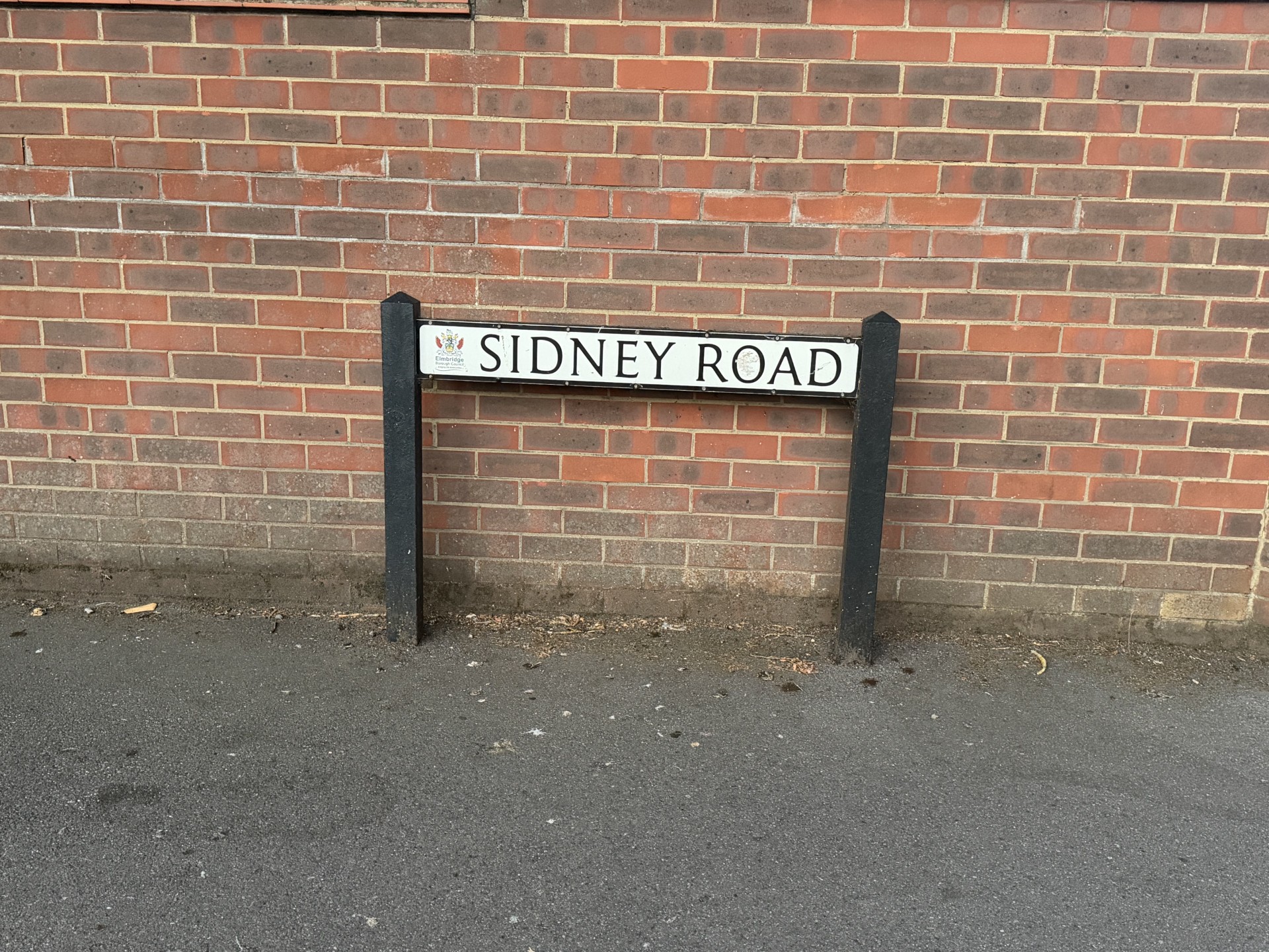
Sidney Road looks like nothing more than a Victorian residential street. It is, in fact, a nineteenth-century carriage way wearing tarmac.
The modern road runs between Terrace Road and Rydens Road, following an earlier private carriage way that extended from Terrace Road towards Rydens Road. Its northern section crossed the parkland of Walton Lodge and served as the estate approach. In 1867–68, that part of the route was laid down as a regular thoroughfare and became known as Sidney Road (Stonebanks, 1982, p. 13). The route survived even as the mansion, farmhouse, parkland and neighbouring Cottimore estate disappeared around it.
In 1935, when Cottimore House, the estate’s last surviving mansion, was pulled down, the marble fireplace surrounds from its main reception rooms were broken up and cast as rubble to fill potholes in Cottimore Lane, and the oak panelling of the main staircase was burned as firewood. Walton, as Stonebanks put it, lost one of its most attractive domestic buildings (Stonebanks, 1982, p. 18). What follows is the fuller story: how a private drive through parkland became a public road, why it carries the name of a City of London tea merchant whose principal home was Bowes Manor in Southgate, and what, against the odds, still survives of the estate it once served.
- Named after Thomas Sidney (1805-1889), a City of London tea merchant, alderman and Lord Mayor.
- Sidney purchased Walton Lodge and Cottimore on 20 May 1864.
- The former estate carriage road became Sidney Road in 1867-68.
- Walton, Hersham and Oatlands Cottage Hospital opened at Sidney Road in June 1905.
- Cottimore House, the estate’s last mansion, was demolished in 1935.
- The former Cottimore lake became George Froude Open Space after it was drained in 1946.
The estate before the road
To picture Sidney Road before it existed, take away the houses, the pavements and the parked cars, and put back parkland, pasture and a scatter of ponds. A carriage road entered from Terrace Road, crossed a private park and continued to Walton Lodge, a mansion with its own farm buildings and lake; Cottimore House stood further east, closer to the low ground that led towards Cottimore Lane and Walton Common (Stonebanks, 1982, fig. II).
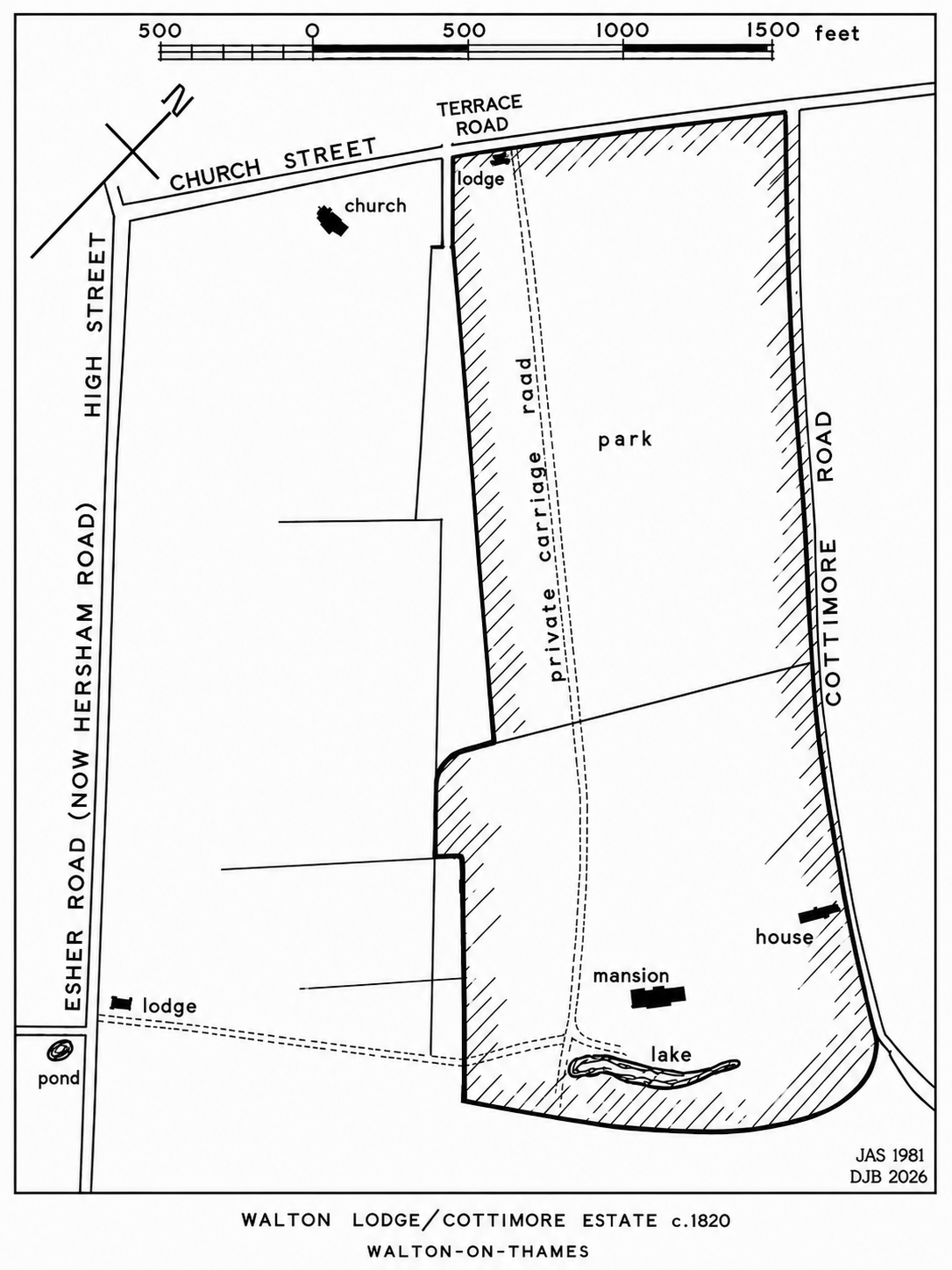
The land belonged, at the start of the nineteenth century, to the former Rectory Manor of Walton-on-Thames. The core Walton Lodge and Cottimore area examined by Stonebanks covered about 95 acres, although the wider properties and farmland sold with the estates were considerably larger. That core area was roughly bounded by Terrace Road to the north-west, Cottimore Lane to the north-east, a lane that later became an extension of Bowes Road and was subsequently renamed Cromwell Road to the south-east, and other private land to the south-west. Some forty of those acres were charged with annual payments of £20 13s 1½d towards the repair of the chancels of two churches, St Mary’s at Walton and St Peter’s at West Molesey (Stonebanks, 1982, pp. 4–5). Walton Lodge itself was substantial enough to be named on the 1816 Ordnance Survey map, one of only three private houses in Walton to be identified there rather than left blank (Stonebanks, 1982, p. 4). Cottimore stood alongside it as a separate property, often under the same ownership but never quite the same estate. Ownership of the combined property changed hands nine times between 1800 and 1935, almost always by sale rather than inheritance, and it is those repeated auctions, and the catalogues they produced, that make so detailed a reconstruction possible at all (Stonebanks, 1982, preface, p. 1).
The name itself is older than any of them. Cottimore, recorded variously as Cotteymore, Cottymore and Cottemore, can be traced back to medieval times, and Stonebanks suggested it derives from “cotter,” a cottager, and “more,” a piece of waste common marsh land. Eighteenth-century manorial customs for Walton-on-Thames single the place out by name, ordering that no horses or cows be pastured on the waste ground of the common fields “except cotteymore” until the fields were clear of corn (Stonebanks, 1982, pp. 2–3).
The ground was wetter than it looks today. Surface water ran north-east from the higher ground around Ashley Park, across the two estates, towards Cottimore and Low Common, gathering in field ditches and storm ponds along the way (Stonebanks, 1982, pp. 1–3). Stonebanks’ own drainage diagram traces a chain of these features running past the lake at Walton Lodge towards Cottimore, and an estate plan marks one underground drain as an “ancient water course” (Stonebanks, 1982, p. 2). The carriage road crossed two of these streams, and after heavy rain it became, in Stonebanks’ words, extremely difficult to use and almost impassable on foot (Stonebanks, 1982, pp. 2, 8). Even once it had become a public road, a short stretch continued to flood most springs until the mid-1920s.
Inclosure and two private roads
The legal shape of the land changed first. The Walton Inclosure Act of 1800 divided and enclosed the parish’s open fields, meadows, commons and waste, and Sarah D’Oyly, who held the Rectory Manor, received land in compensation for the tithes and common rights she gave up (Stonebanks, 1982, p. 6). An indenture of 4 April 1803 made her sole owner of the Walton Lodge and Cottimore estate; Edward Peppin, a local landowner and speculator, bought it soon afterwards (Stonebanks, 1982, pp. 7–8).
The Inclosure Award recorded or authorised two private carriage routes, and it is worth being precise about them, because neither became Sidney Road. A fifteen-foot route across Cottimore Close became Cottimore Lane. A second, sixteen feet wide, was created around 1804 from Esher Road, now Hersham Road, towards Walton Lodge, for the benefit of the owners and occupiers of the adjoining land (Stonebanks, 1982, pp. 3, 8). This Hersham Road approach was shorter and more convenient than the older route; its lodge building survived at 29 Hersham Road when Stonebanks was writing in 1982.
Sidney Road descends instead from the older and longer carriage way, which ran from Terrace Road towards Rydens Road. Its northern section, past a small gatehouse and across roughly half a mile of parkland and the two drainage streams, was the approach to Walton Lodge itself; the rest of the route lay beyond the estate boundary. That gatehouse stood until the mid-1920s, long after the northern section had become a public thoroughfare, giving earlier generations a visible reminder of where the private estate had once begun (Stonebanks, 1982, p. 8).
A grander house than the one Sidney bought
The Walton Lodge that later owners inherited was not the mansion of earlier decades. Sale catalogues from 1823 and 1824 describe a brick house with pilasters, a portico and stone steps, its rooms including a breakfast room, dining parlour, drawing room, library and conservatory, an oak staircase leading to a long upper gallery, and extensive coach houses and stabling (Stonebanks, 1982, pp. 9–10). One catalogue claimed the house had been built by Sir John Vanbrugh; Stonebanks could find no confirmation of this in the architect’s published record, and the attribution should be treated as estate tradition rather than fact (Stonebanks, 1982, p. 4).
John William Gooch Spicer bought the estate in 1824. During his ownership the grand mansion disappeared, probably in the mid-1850s, either by fire or demolition, and a smaller farmhouse was built near its former site (Stonebanks, 1982, p. 11). By the time Thomas Sidney entered the story in 1864, the house that gave Walton Lodge its name had already gone. What remained was a working farm, a park, two carriage approaches and a great deal of development potential.
The tea merchant who bought the park
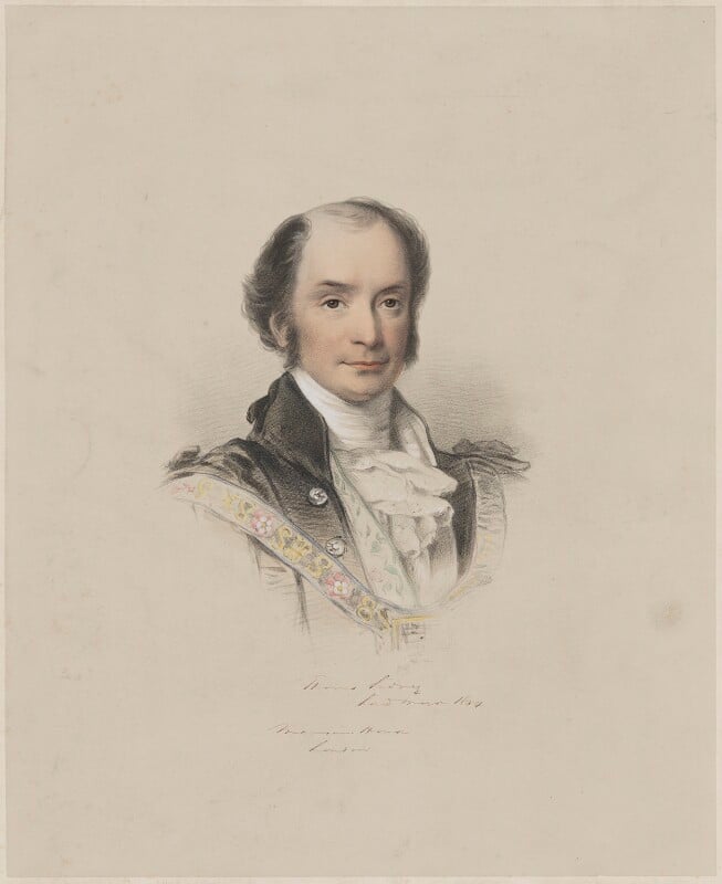
Thomas Sidney was born in Stafford around 1 January 1805, the son of William Sidney, a draper (History of Parliament Trust, n.d.). He moved to London in the late 1820s and built a wholesale tea-importing business, one of the defining trades of nineteenth-century British commerce, and used the wealth and standing it brought him to enter the civic life of the City (History of Parliament Trust, n.d.; Stonebanks, 1982, p. 12). He was elected an alderman in 1844 and served as Lord Mayor of London in 1853–54 (Stonebanks, 1982, p. 12). A hand-coloured lithograph in the National Portrait Gallery, dated to his mayoral year, shows him in civic dress; it is the clearest surviving image of the man Sidney Road commemorates (National Portrait Gallery, n.d.-a, n.d.-b).
He sat twice as Member of Parliament for Stafford, from 29 July 1847 to 7 July 1852 and again from 3 August 1860 until 1865, described by Stonebanks as a Liberal-Conservative in his first term and a Liberal in his second (UK Parliament, n.d.; Stonebanks, 1982, p. 12). Stonebanks gives the end of that second term as 1863; the parliamentary record gives 11 July 1865, and this article follows the latter while noting the disagreement.
He was never knighted, whatever later references sometimes claim, and Stonebanks offers an explanation for it. The honour was customarily conferred on London’s Lord Mayors, but Sidney was passed over. During his mayoral year the presidency of Christ’s Hospital, the Blue Coat School, fell vacant on the death of Alderman Thompson. The serving Lord Mayor had been elected to fill such vacancies on previous occasions, but this time the Duke of Cambridge, cousin of Queen Victoria, was also nominated and won the contest. Sidney took it badly. On the following Easter Tuesday, when the boys of Christ’s Hospital walked in procession down Cheapside to receive gifts of money from the Lord Mayor by tradition, he refused to receive them at the Mansion House. Stonebanks suggests that this display of pique may have cost him the Queen’s favour, and with it the knighthood (Stonebanks, 1982, p. 12; History of Parliament Trust, n.d.).
He married twice. His first wife, Sarah, was the daughter of William Hall; their daughter Ellen married the Reverend Sir Edward Graham Moon, Rector of Fetcham, in 1857. His second wife, Eleanour Mary, was the daughter of William Ward, and each of their seven children, three boys and four girls, was given Stafford as a second Christian name, tying the family to Sidney’s birthplace (Stonebanks, 1982, p. 12). The family home was Bowes Manor at Southgate in Middlesex, though Sidney also owned property elsewhere in the country, from Liverpool to Brighton; the Victoria County History records that part of Bowes, including the manor house site, was sold to him as its lessee around 1866 (Stonebanks, 1982, p. 12; Victoria County History, 1976). That Middlesex property left its own mark on Walton: Bowes Road, named at the same time as Sidney Road, was named after it (Stonebanks, 1982, p. 13).
Why Walton?
The sources establish what Sidney bought and when, but not why he chose Walton-on-Thames, and the obvious explanation, that he wanted a country residence, does not fit the facts. The grand Walton Lodge mansion had already gone before he arrived, replaced by a farmhouse; and Sidney did not even move into that. The Reverend Charles Hugh Lushington, formerly vicar of Walton, took up residence there in the summer of 1864 and remained until his death in 1874 (Stonebanks, 1982, p. 13). What the evidence points to instead, in Stonebanks’ assessment, is a straightforward development purchase: within a few years it had become clear that Sidney intended to divide the Walton Lodge land and sell it for housing (Stonebanks, 1982, p. 12).
The opportunity arose from another family’s misfortune. John William Gooch Spicer, whose family owned the wider Esher Place estate, died in July 1862; his widow died the following March; their eldest son then put the estate up for sale. Most of it went in July 1863 to a consortium that included Sidney. A second transaction, on 20 May 1864, made Sidney the outright purchaser of Walton Lodge for £20,000 and Cottimore for £3,060 (Stonebanks, 1982, p. 11). The figures reflect the very different scale of the two properties: Walton Lodge comprised around 250 acres of farmland with its farmhouse and outbuildings, while Cottimore was a smaller residential estate centred on a long, low villa set among lawns and shrubbery walks (Stonebanks, 1982, p. 11).
Turning a drive into a road
The change that gave the street its name and its public status came within three years of Sidney’s purchase. In 1867–68, Stonebanks records, the private carriage road running from Terrace Road across Walton Lodge park “was laid down as a regular thoroughfare” and became known as Sidney Road (Stonebanks, 1982, p. 13). No original naming resolution or highway-adoption order has yet come to light to confirm exactly how the change was formalised, but its effect is not in doubt.
The new road divided the estate, and Sidney used that division to release land. Roughly a third of it, on the western side, was sold for streets and housing. Before this, roads approaching from the older parts of Walton, off the High Street and Hersham Road, had simply ended at the estate boundary as gated cart tracks; as land was released, those dead ends were opened up and connected into a wider network (Stonebanks, 1982, pp. 12–13). Some barriers survived far longer than the rest: the last obstruction on a former estate track, at the eastern end of Crutchfield Lane, was not levelled, drained, surfaced and adopted by the local authority until 1975 (Stonebanks, 1982, p. 13), a reminder that the conversion from private park to public suburb was gradual and uneven rather than a single act of Victorian planning.
Sidney made his will on 12 June 1874, appointing his wife as executrix and trustee, with his sons Thomas Stafford, William Stafford and Herbert Stafford to become trustees once they turned twenty-one (Stonebanks, 1982, p. 13). He died at St Leonards-on-Sea in March 1889; the History of Parliament database gives the date as 10 March, Stonebanks as 11 March, a discrepancy this article notes rather than resolves (History of Parliament Trust, n.d.; Stonebanks, 1982, p. 13). He was buried at St Michael-at-Bowes in Southgate, where two stained-glass windows were later placed in his memory (Stonebanks, 1982, p. 13). The development policy he began did not stop with him. His trustees carried on selling estate land, and by the end of the century the whole western side of Sidney Road had gone to housing, roughly a third of the eastern side near Terrace Road had been sold with five substantial houses built on it, and the remaining open land, known as Sidney Park, had been absorbed into the neighbouring Cottimore estate as pasture (Stonebanks, 1982, p. 13).
A neighbourhood in named houses
Development did not happen all at once, or to a single plan. It proceeded in stages, first under Sidney himself and then under his trustees, with drainage and surfacing lagging some way behind the housebuilding, so that early Sidney Road was, for a long stretch of its history, both a suburban street and a building site backing onto open fields.
The earliest household so far traced there is the Ballard family. A modern transcription of the 1891 census places Ellen Hester Ballard and her family on Sidney Road, and by the 1901 census the household is recorded more precisely at The Poplars, Sidney Road (Friends of Heene Cemetery, n.d.); the original returns have not yet been checked against this transcription. Kelly’s 1913 directory confirms the family still there, listing Mrs Ballard and Thomas Alexander Ballard at The Poplars (Kelly’s Directories Ltd., 1913, p. 449).
That 1913 directory gives the fullest surviving snapshot of the road before the First World War. It is an alphabetical list of Walton’s private residents rather than a dedicated street directory, so it shows who lived on Sidney Road that year without necessarily showing every household or their geographical order:
| Residence | Resident or residents listed in 1913 |
|---|---|
| Candria | Rupert Allcard |
| The Poplars | Mrs Ballard; Thomas Alexander Ballard |
| The Anchorage | Harry Alfred Balston |
| The Hut | George Balz |
| Laurel Bank | William C. P. Baylis |
| The Meadows | Harry White Birch |
| Sidney Lodge | Robert Russell Boyd |
| Derwent Lodge | Mrs De Best |
| St Heliers | Joseph Gardner |
| Howick Lodge | Stanley Garner |
| Minstead | Henry Douglas King |
| The Sheil | Ernest Archibald Longhurst |
| Dunblane | Robert MacLaren |
| Mon Rêve | Cecil Mannering |
| Westhays | Govan Manning |
| The Nook | Arthur James Matthews |
| Sherwood Lodge | Mrs Harrison |
| Farringford | Walter Clemence |
| Coombs-Moss | Cecil Milton Hepworth |
| Glenwood | Arthur Moon |
| Mead View | Charles David Morris |
| Belmont | William Frederick Morse |
(Kelly’s Directories Ltd., 1913, p. 449)
The names carry their own small social history: some borrow from places elsewhere (St Heliers, Dunblane, Farringford, Howick Lodge), others describe the landscape they sat in (The Poplars, The Meadows, Laurel Bank, Glenwood). None of this proves architectural style on its own; a house called “Lodge” was not necessarily built as an estate lodge. What it does prove is a settled, individually named residential community well established by 1913.
One name on that list connects Sidney Road to a story of national importance. Cecil Hepworth, one of the most important pioneers of early British cinema, was listed at Coombs-Moss in Sidney Road in 1913 (Kelly’s Directories Ltd., 1913, p. 449). He had converted a house in Walton-on-Thames into a studio in 1899 and went on to become one of the most respected film-makers of his era (BFI Screenonline, n.d.). The directory entry also corrects an earlier working assumption that placed him at Tenby Lodge; that address, the same page shows, belonged instead to Ernest Sidney Camber, on Hersham Road. Coombs-Moss itself has not been matched to a modern property, and that remains an open research question.
One building on the road preserves a direct link to the neighbouring estate rather than to Sidney’s own development. Cottimore Lodge, a two-storey house with a steeply pitched gabled roof at 119 Sidney Road, near the junction with Stuart Avenue, was built when Sidney Road was laid out and received an extension in 1977. Stonebanks, writing in 1982, identified it as the only building then surviving from the Cottimore estate (Stonebanks, 1982, pp. 14–15, 19). It remains a private residence.
At the northern end, the junction with Terrace Road brought Sidney Road into a mixed area of homes and working premises, whose individual histories belong more properly to Terrace Road and Churchfield Road.
A hospital for three towns
The most consequential addition to Sidney Road in this period was not a private house at all. At its junction with Rodney Road stood the Walton, Hersham and Oatlands Cottage Hospital, an institution built to serve three communities, not just one street, and supported by subscriptions, charitable donations and contributions from patients who could afford to pay, in the decades before the National Health Service existed.
Wendy Hughes credits Dr George White Drabble, of the Manor House in Church Street, with the gift of the freehold site at the corner of Sidney Road and Rodney Road (Hughes, 2003, p. 55); the original conveyance recording that gift has not yet been examined. Published accounts have since disagreed about the hospital’s date, Hughes giving 1904 in one place and 1906 in a caption elsewhere (Hughes, 2003, pp. 8, 55). Elmbridge Museum’s surviving hospital records resolve the confusion: the Duchess of Albany laid the foundation stone on 28 May 1904, and the hospital opened to patients in June 1905 (Elmbridge Museum, n.d.). The 1904 date marks the ceremony, not the opening; the 1906 date in Hughes appears to be an error.
Cottage hospitals of this kind offered local inpatient nursing and surgery on a scale smaller than the big London teaching hospitals, treating patients within the community their own doctors already knew, and depending for their survival on subscriptions, donations and whatever patients could afford to contribute themselves. Walton’s fourth annual report, covering 1908 and held by Elmbridge Museum, shows an institution already working hard: 172 patients admitted that year, fifty more than in 1907, and 79 surgical operations, with patients staying an average of sixteen and a half days (Elmbridge Museum, n.d.). The report tracked outcomes, cured, improved, relieved, transferred or died, and recorded the conditions treated in the language of the day: a patient cured of a “poisoned hand,” another described as having had a “hysteroid attack,” and one death recorded from infantile diarrhoea, a reminder of how dangerous ordinary infectious and gastrointestinal illness still was before modern sanitation and antibiotics (Elmbridge Museum, n.d.).
The committee that year singled out the Matron, Miss Brown, for particular thanks, and her role reached well beyond the wards: the same report carries her request that women intending to sew clothing for patients contact her first about suitable patterns and materials, a small detail that says a great deal about how closely the hospital’s day-to-day running depended on donated goods and volunteer labour (Elmbridge Museum, n.d.). A small organ, given by several supporters, was reportedly much appreciated by both nurses and patients, and garden fêtes, photographed by Elmbridge Museum around 1932 to 1934, show crafts stalls and costumed volunteers raising funds well into the hospital’s later years (Elmbridge Museum, n.d.). One surviving photograph from around 1915 to 1920 shows the children’s ward, two nurses attending young patients; the museum’s own interpretation suggests one nurse may have been Vera Wright, also referred to as Vera Neal, though that identification remains unconfirmed (Elmbridge Museum, n.d.).
The building itself changed considerably over its lifetime. Hughes records several extensions before its eventual demolition, though no complete architectural chronology of those changes has yet been assembled (Hughes, 2003, p. 55). Elmbridge Museum gives its closure as the early 1990s; Hughes dates the demolition to 1993 (Elmbridge Museum, n.d.; Hughes, 2003, p. 55). The site’s medical association did not end there. Walton Community Hospital and Fort House Surgery both still operate from Rodney Road today, part of a different system entirely from the voluntary hospital that first occupied the ground, but a continuation, in spirit, of more than a century of local care on the same corner (NHS, n.d.-a, n.d.-b).
Mud, floods and a footpath fine
For all its houses and its hospital, Sidney Road stayed close to the wet, difficult ground it had been built across. Stonebanks preserved older residents’ memories of the road around 1900 as rough, muddy and full of potholes, a direct legacy of the drainage patterns described earlier; a stretch of about twenty yards continued to flood to a depth of a few inches most springs until the mid-1920s (Stonebanks, 1982, pp. 1–2). Wendy Hughes notes more broadly that many Walton roads remained unmade before the First World War and were watered in summer simply to keep the dust down (Hughes, 2003, p. 8); Sidney Road’s own poor condition in wet weather is independently confirmed by Stonebanks.
The clearest evidence of what this meant for ordinary residents comes from a Walton District Bench case in April 1914. Five people, E. Andrews, P. Hennesey, E. Huckins, B. Ellaway and B. Fletcher, all inhabitants of Walton, were each fined two shillings and sixpence for cycling on the Sidney Road footpath. Their explanation was simple: the road itself was in a bad state in wet weather (Stonebanks, 1982, p. 2). It is a small case, but it tells the human side of the drainage story more vividly than any estate plan.
Stonebanks set that case against a much older one, almost exactly 250 years earlier. Landowners were legally obliged to keep watercourses on their land clear and to stop water flooding a public footpath or highway, and the Surrey Quarter Sessions record for Easter and Midsummer 1664 notes that Thomas Viner, a knight and an alderman of London, had allowed a watercourse lying against Low Common in Walton to overflow. Such prosecutions were common enough to make up around a fifth of all indictments, and the penalty was usually a fine of a few shillings (Stonebanks, 1982, p. 2). The same stretch of low, wet ground was still generating fines a quarter of a millennium later.
The neighbouring lane went through the same slow process. Cottimore Lane, created by the Inclosure Award as a fifteen-foot private carriage road, was eventually declared a public highway repairable by the inhabitants of Walton following a hearing before the House of Lords in 1914; the levelling, draining and surfacing of 334 yards at its Terrace Road end was finished by May of that year (Stonebanks, 1982, p. 3).
The end of Cottimore
While Sidney Road filled in with houses, the neighbouring Cottimore estate had a slower, quieter afterlife. Frederick Bartleet (1832–1898), a London merchant believed to have remained a bachelor, bought the estate in the late 1880s, by which time it covered about 33 acres. He landscaped the grounds, laid a tennis court and created ornamental waters and a water garden fed by the stream from the lake, which covered about an acre, held two small islands and stretched from Sidney Road to within a hundred yards of Cottimore Lane. He died at Cottimore in March 1898, and at a sale that June the estate was bought by agents acting for Augustus Arthur Perceval, 8th Earl of Egmont (Stonebanks, 1982, pp. 14–15).
The new owner was an unlikely country gentleman: a former Metropolitan Fire Brigade man who had gone on to keep Chelsea Town Hall, and who once turned a fire hose on demonstrators outside it, resigning after his employers refused to cover his legal costs. He succeeded to the earldom only in 1897, on the death of a cousin without issue (Stonebanks, 1982, p. 15). Around 1901, during the Egmonts’ occupation, the Walton Lodge farmhouse was demolished and its farm buildings left to fall into disrepair (Stonebanks, 1982, p. 16). The earl died in 1910 and his widow Kate, the dowager countess, left Cottimore in 1920.
James Brand McArthur bought the estate that June, comprising the house, outbuildings, two cottages and about thirty-three acres. He and his wife Elizabeth took a far more active part in Walton’s social life than the Egmonts had, entertaining and holding summer garden parties in aid of local charities (Stonebanks, 1982, pp. 16–17). After McArthur’s death in March 1929, Elizabeth remained at Cottimore about five years while parts of the land were let on short terms: the lodge cottage on Sidney Road at five pounds a month, the gardener’s cottage at a token five pounds a year, and the meadowland along the eastern side of Sidney Road for grazing, sixteen acres at an annual rent of thirty-eight pounds and a further six acres at a shilling per cow per week (Stonebanks, 1982, p. 17).
The estate was sold twice in quick succession in 1934–35. John Thomas Overton bought it in August 1934 for £8,500, intending to resell it for housing; in March 1935, after resolving old rectorial liabilities attached to the land, he sold it on to William Edward Brown for £12,250 (Stonebanks, 1982, pp. 17–18). Cottimore House was then demolished, its marble fireplaces broken up to fill potholes in Cottimore Lane and its oak panelling burned as firewood (Stonebanks, 1982, p. 18), a fate that would strike most readers today as an extraordinary waste of a historic building, and a measure of how differently the interwar years regarded architectural salvage.
New streets filled the site, though not all at once. Stuart Avenue was laid out close to the former Walton Lodge site and the surviving lodge cottage. The Egmont name was perpetuated later and in two places: Egmont House, a block of council flats in Cromwell Road, and Egmont Road, serving a residential development between Sidney Road and Cottimore Lane that was not completed until 1980 (Stonebanks, 1982, pp. 16, 18–20).
The lake area resisted building longest, having been judged unsuitable for the purpose. Shortly after the outbreak of the Second World War the land was offered to the local authority, ostensibly for wartime allotments; the council declined but agreed in April 1941 that ten rods could be let for cultivation, on the understanding that it would not be responsible for clearing or fencing the site (Stonebanks, 1982, p. 19). In 1946 the lake itself, the last substantial piece of the old landscape, was drained, its stream piped and the site levelled. It was declared an open space for public use and named George Froude Park, after George H. Froude, a member of the Urban District Council who had served four terms as chairman; Elmbridge Borough Council now lists it officially as George Froude Open Space (Stonebanks, 1982, p. 19; Elmbridge Borough Council, n.d.). Stonebanks, writing of the bluebells that still came into bloom each May in the gardens on the west side of Sidney Road, thought them doubtless descended from those that had grown in profusion in the meadow and woodland of the park 150 years before; it is a plausible observation rather than a proven line of descent (Stonebanks, 1982, p. 19).
A historian who grew up among the ditches
The man responsible for recovering almost all of this detail lived on the road himself. John A. Stonebanks signed the preface to Cottimore and Walton Lodge from 88 Sidney Road, Walton-on-Thames, and admitted in it to a personal interest in the subject, having lived for many years on a very small part of the former Walton Lodge estate (Stonebanks, 1982, preface). His childhood there, he recalled, included catching tadpoles and newts in the local ditches, watching pond skaters, venturing onto the frozen Cottimore lake in hard winters, and playing tennis on the courts at Cottimore House (Stonebanks, 1982, preface). Those memories explain his interest in the place, but not his conclusions: those he built from sale catalogues, title-deed abstracts and local records, the same documentary evidence this account draws on throughout.
What survives today
Most of the physical estate has gone. The Walton Lodge mansion and the farmhouse that replaced it have both disappeared; Cottimore House, its stables and outbuildings went in 1935; the lake and water gardens were removed in 1946; the Terrace Road gatehouse, which had stood into the 1920s, is also long gone (Stonebanks, 1982, pp. 8, 16–19).
What remains is, above all, the route. Sidney Road still runs, in broad terms, along the line of the old carriage drive from Terrace Road towards the former Walton Lodge site, and that survival matters more than it might first appear. Estate houses can burn down, parkland can be sold off in parcels, and lakes can be drained and built over, but a road that continues to serve a town tends to persist, carrying the shape of a vanished landscape forward in nothing more than its alignment (Stonebanks, 1982, pp. 8, 13).
A short walk along it makes the layered history legible. Starting at Terrace Road, the route enters what was once the northern edge of Walton Lodge park. Near Stuart Avenue, Cottimore Lodge at 119 Sidney Road preserves the clearest surviving building connection to the estate; its current condition, and whether it carries any heritage designation, has not yet been formally assessed. Further east, George Froude Open Space occupies the former lake, complete with play equipment for a new generation of local children (Elmbridge Borough Council, n.d.; Elmbridge Borough Council, 2024). Towards Rodney Road, the continuing presence of Walton Community Hospital and Fort House Surgery recalls the public role first established by the cottage hospital in 1905 (NHS, n.d.-a, n.d.-b). Stonebanks recorded in 1982 that most of the old stream had been culverted, although one section still ran openly across Low Common before turning south near the reservoir embankment (Stonebanks, 1982, p. 19).
The neighbourhood’s street names form a kind of informal map of what has otherwise vanished. Stonebanks appended a full list of the roads laid down for the residential development of the Cottimore and Walton Lodge estates, and it is worth setting out in full, because it also records how much of each road actually lay within the old estate boundary rather than beyond it:
| Road | Extent within the estate |
|---|---|
| Alpine Road | Whole road |
| Bowes Road | Part of west side |
| Churchfield Road | East end |
| Cottimore Avenue | Whole road |
| Cottimore Lane | West side |
| Cottimore Terrace | Whole road |
| Cromwell Close | Whole road |
| Cromwell Road | West side |
| Crutchfield Lane | East end |
| Egmont Road | Whole road |
| Esher Avenue | Whole road |
| Fairfax Close | Whole road |
| Kingsbridge Road | Whole road |
| Kings Close | Whole road |
| Kings Road | East end |
| Lancaster Court | Whole road |
| Monks Crescent | Whole road |
| Sidney Road | Northern half |
| Stuart Avenue | Whole road |
| Terrace Road | Part of south side |
| Willow Hayne Drive | Whole road |
(Stonebanks, 1982, p. 20)
Stonebanks lists the open space created from the former Cottimore lake, on the same page, simply as George Froude Park (Stonebanks, 1982, p. 20).
Not every name in that list has a confirmed origin, but the best-supported ones tell a coherent story on their own: Sidney Road for the man who bought the estate, Bowes Road for his Southgate property, and the Cottimore names for the older estate itself. Two details in the table repay attention. Cottimore Crescent, which Stonebanks names elsewhere as one of the streets perpetuating the old name, does not appear in this list at all, so it should not be assumed to lie within the estate development area. And Sidney Road is listed as its northern half only. That does not mean the older carriage way ended at the estate boundary: the longer private route continued southwards towards Rydens Road, but only its northern section crossed Walton Lodge land, and it is that section which the appendix records as part of the estate development area (Stonebanks, 1982, pp. 1, 20).
Part of a wider pattern
Sidney Road’s story is a local one, but the forces that produced it were not. Walton Lodge and Cottimore were, for the first half of the nineteenth century, exactly the kind of private country estates that ringed London and its satellite towns: a mansion, parkland, tenanted farmland and private approach roads, held by a succession of owners with City or professional wealth (Stonebanks, 1982). As transport links to London improved, land of this kind became steadily more valuable as building plots than as parkland, and estates across the region were sold, divided and built over in the decades either side of 1870. Ashley Park, another private estate on the edge of Walton, went the same way in the 1920s, its grounds now remembered largely in the street names built across them (see The Lost Estate of Ashley Park). That broader pattern is offered here as context rather than as a claim established by the sources cited for Sidney Road itself. What is distinctive about Sidney Road is how directly its street plan preserves the estate’s own internal geography: not a new grid imposed on cleared land, but the surviving line of an older private carriage way, whose northern section crossed Walton Lodge park and was laid down as Sidney Road in 1867–68.
Thomas Sidney’s purchase can be read the same way. A City tea merchant, alderman and Lord Mayor used part of his fortune to acquire a substantial Surrey estate, which his trustees later broke up for development (Stonebanks, 1982; History of Parliament Trust, n.d.). Historians have often described commercial and civic wealth made in the City being reinvested in Home Counties land, offering both a country base and a long-term investment separate from the business in town, and Sidney’s Walton purchase sits comfortably within that description; the sources cited here establish his own case rather than the general trend.
The cottage hospital built on land he once owned belonged to its own national movement. Voluntary local hospitals funded by subscription and donation spread across Britain from the mid-nineteenth century, decades before the NHS was created in 1948, and Walton’s, serving three communities together, was a small working example of that model (Elmbridge Museum, n.d.).
The road’s connection to Cecil Hepworth ties it, however lightly, to the story of early British cinema. Hepworth was among the pioneers of British film-making, working from a studio in Walton from 1899 onwards (BFI Screenonline, n.d.), and his residence at Coombs-Moss places one of that industry’s central figures on this specific street rather than merely in the town in general.
Roads, in the end, are survivors. Houses, mansions and even lakes can disappear within a generation, as Walton Lodge, Cottimore House and the Cottimore lake all did. A route that keeps serving a practical purpose tends to outlive every building it originally connected, and Sidney Road, read alongside Bowes Road and the surviving Cottimore names nearby, is a compact, well-documented example of a process repeated, with local variations, right across the suburbanised fringes of Surrey.
Sidney Road: timeline
| Date | Event |
|---|---|
| 8 October 1740 | A Hand in Hand fire-insurance policy, issued to the Hon. Major Roger Handasyd, describes a large house believed to have been Walton Lodge (Stonebanks, 1982, pp. 4–5). |
| 1800 | The Walton Inclosure Act provides for the division and enclosure of the parish’s open fields, meadows, commons and waste (Stonebanks, 1982, p. 6). |
| 4 April 1803 | Sarah D’Oyly becomes sole owner of the Walton Lodge and Cottimore estate (Stonebanks, 1982, p. 7). |
| c. 1804 | A private carriage road is awarded from Esher Road (now Hersham Road) towards Walton Lodge; this did not become Sidney Road (Stonebanks, 1982, p. 8). |
| 1816 | Walton Lodge is named on an early Ordnance Survey map, one of only three private residences in Walton so identified (Stonebanks, 1982, p. 4). |
| 1823–24 | Walton Lodge, Cottimore and associated land are put up for sale; the catalogues describe the mansion in detail (Stonebanks, 1982, pp. 9–10). |
| September 1824 | John William Gooch Spicer, a London banker and stockbroker whose family owned Esher Place, buys Walton Lodge, Cottimore, the cottages and outbuildings with about 400 acres (Stonebanks, 1982, p. 10). |
| Probably mid-1850s | The original Walton Lodge mansion is destroyed by fire or demolished; a smaller farmhouse is built nearby (Stonebanks, 1982, p. 11). |
| July 1863 | The Esher Place estates, including Walton Lodge and Cottimore, are sold; a consortium including Thomas Sidney buys most of the lots (Stonebanks, 1982, p. 11). |
| 20 May 1864 | Thomas Sidney buys Walton Lodge for £20,000 and Cottimore for £3,060 (Stonebanks, 1982, p. 11). |
| Summer 1864 | The Reverend Charles Hugh Lushington moves into the Walton Lodge farmhouse (Stonebanks, 1982, p. 13). |
| 1867–68 | The carriage road from Terrace Road becomes a regular thoroughfare and is named Sidney Road (Stonebanks, 1982, p. 13). |
| Late 1860s onward | Land west of Sidney Road is sold for roads and housing (Stonebanks, 1982, p. 13). |
| 1867–68 | The lane from Hersham Road to Cottimore Lane becomes Bowes Road, named after the Sidney family’s Bowes Manor estate at Southgate (Stonebanks, 1982, p. 13). |
| 12 June 1874 | Thomas Sidney makes his will (Stonebanks, 1982, p. 13). |
| 10/11 March 1889 | Thomas Sidney dies at St Leonards-on-Sea, where he had a summer residence; he is buried at St Michael-at-Bowes, Southgate. Stonebanks gives 11 March, the History of Parliament 10 March (History of Parliament Trust, n.d.; Stonebanks, 1982, p. 13). |
| 1891 | The Ballard family, the earliest household so far traced, is recorded on Sidney Road (Friends of Heene Cemetery, n.d.). |
| 1901 | The Ballard household is recorded at The Poplars, Sidney Road (Friends of Heene Cemetery, n.d.). |
| 28 May 1904 | The Duchess of Albany lays the foundation stone of Walton, Hersham and Oatlands Cottage Hospital (Elmbridge Museum, n.d.). |
| June 1905 | The Cottage Hospital opens at the corner of Sidney Road and Rodney Road (Elmbridge Museum, n.d.). |
| 1908 | The hospital’s fourth annual report records 172 admissions and 79 operations (Elmbridge Museum, n.d.). |
| 1913 | Kelly’s Directory lists over twenty named households on Sidney Road, including Cecil Hepworth at Coombs-Moss (Kelly’s Directories Ltd., 1913, p. 449). |
| April 1914 | Five residents are fined for cycling on the Sidney Road footpath, citing the road’s poor condition (Stonebanks, 1982, p. 2). |
| c. 1915–20 | A surviving photograph shows the hospital’s children’s ward (Elmbridge Museum, n.d.). |
| Until mid-1920s | A short section of Sidney Road continues to flood most springs (Stonebanks, 1982, p. 2). |
| Mid-1920s | The gatehouse at the Terrace Road entrance is demolished (Stonebanks, 1982, p. 8). |
| June 1920 | James Brand McArthur buys the estate: house, outbuildings, two cottages and about thirty-three acres (Stonebanks, 1982, p. 16). |
| March 1929 | James McArthur dies; Elizabeth McArthur remains at Cottimore about five years (Stonebanks, 1982, p. 17). |
| August 1934 | John Thomas Overton buys the remaining Cottimore estate for £8,500 (Stonebanks, 1982, p. 17). |
| March 1935 | William Edward Brown buys the estate for £12,250 (Stonebanks, 1982, pp. 17–18). |
| 1935 | Cottimore House is demolished; its marble fireplace surrounds are broken up to fill potholes in Cottimore Lane and its oak staircase panelling burned as firewood (Stonebanks, 1982, p. 18). |
| April 1941 | The council declines the offer of the lake land for wartime allotments but allows ten rods to be let for cultivation (Stonebanks, 1982, p. 19). |
| 1946 | The Cottimore lake is drained, the stream piped and the site levelled; it becomes George Froude Park, now George Froude Open Space (Stonebanks, 1982, p. 19; Elmbridge Borough Council, n.d.). |
| 1975 | The last surviving barrier on a former estate track, at Crutchfield Lane, is removed and the road adopted (Stonebanks, 1982, p. 13). |
| 1977 | Cottimore Lodge, 119 Sidney Road, is extended (Stonebanks, 1982, pp. 14–15). |
| 1980 / 1982 | John A. Stonebanks publishes The Thames at Walton and Weybridge and, two years later, Cottimore and Walton Lodge (Stonebanks, 1980, 1982). |
| Early 1990s | Walton Cottage Hospital closes (Elmbridge Museum, n.d.). |
| 1993 | The former hospital building is demolished (Hughes, 2003, p. 55). |
Open questions
Not everything about Sidney Road’s history is settled, and it is worth being honest about the gaps. The account given above is Stonebanks’ observation as at 1982. No original 1867–68 road-naming or highway-adoption record has been located, so the precise administrative process behind the “regular thoroughfare” of that year remains undocumented. The original census returns behind the 1891 and 1901 Ballard-family transcriptions have not been inspected. Dr Drabble’s gift of the Cottage Hospital site is recorded by Hughes but not yet confirmed. The exact modern location of Coombs-Moss, Cecil Hepworth’s Sidney Road home, has not been established. Stonebanks’ suggestion that surviving bluebells descend from Walton Lodge park is his own plausible observation, but not verified.
Frequently asked questions
Why is Sidney Road called Sidney Road? It is named after Thomas Sidney (1805–1889), who bought Walton Lodge and Cottimore in 1864. The private carriage road that crossed the estate was made into a regular thoroughfare and took his name in 1867–68 (Stonebanks, 1982).
Who was Thomas Sidney? A City of London tea merchant who became an alderman, served as Lord Mayor of London in 1853–54, and represented Stafford as an MP in two separate periods, 1847–52 and 1860–65.
Was Sidney Road originally a private carriage road? Yes. The modern road follows an earlier private carriage way that extended from Terrace Road towards Rydens Road. Its northern section crossed Walton Lodge park and served as the estate approach. In 1867–68, that estate section was laid down as a regular thoroughfare and became known as Sidney Road.
Was Thomas Sidney knighted? No. He is sometimes mistakenly called “Sir Thomas Sidney,” but the History of Parliament record confirms he held no knighthood.
When did Walton Cottage Hospital open? The Duchess of Albany laid its foundation stone on 28 May 1904, and it opened to patients in June 1905, at the corner of Sidney Road and Rodney Road.
What survives from Walton Lodge and Cottimore today? The route of Sidney Road itself, Cottimore Lodge at 119 Sidney Road, George Froude Open Space on the site of the former Cottimore lake, and street names including Sidney Road, Bowes Road and Cottimore Avenue.
Sources
- Elmbridge Borough Council (n.d.) 'George Froude Open Space'. Available at: https://www.elmbridge.gov.uk/leisure-and-culture/green-spaces/parks-play-areas-and-green-spaces-directory/george-froude-open ↗ (Accessed: 2 August 2026).
- Elmbridge Borough Council (2024) 'George Froude Open Space: Creating a positive community impact'. Available at: https://www.elmbridge.gov.uk/news/2024/george-froude-open-space-creating-positive-community-impact ↗ (Accessed: 2 August 2026).
- BFI Screenonline (n.d.) 'Hepworth, Cecil (1874-1953): Biography'. Available at: http://www.screenonline.org.uk/people/id/450004/index.html ↗ (Accessed: 4 August 2026).
- Elmbridge Museum (n.d.) 'Sickness & health: Walton, Hersham and Oatlands Cottage Hospital'. Available at: https://elmbridgemuseum.org.uk/online-exhibitions/sickness-health/ ↗ (Accessed: 2 August 2026).
- Friends of Heene Cemetery (n.d.) Gertrude Ballard (buried 1925).
- History of Parliament Trust (n.d.) 'Thomas Sidney'. Available at: https://membersafter1832.historyofparliamentonline.org/members/5743 ↗ (Accessed: 2 August 2026).
- Hughes, W. (2003) Walton-on-Thames. Tempus Publishing.
- Kelly's Directories Ltd. (1913) 'Kelly's Directory of Surrey (p. 449)'. Available at: https://specialcollections.le.ac.uk/digital/collection/p16445coll4 ↗ (Accessed: 2 August 2026).
- National Portrait Gallery (n.d.-a) 'Thomas Sidney (1805-1889), Lord Mayor of London and politician'. Available at: https://www.npg.org.uk/collections/search/person/mp92618/thomas-sidney ↗ (Accessed: 2 August 2026).
- National Portrait Gallery (n.d.-b) 'Thomas Sidney [Hand-coloured lithograph by an unknown artist, 1853-1854, NPG D41694]'. Available at: https://www.npg.org.uk/collections/search/portrait/mw205880/Thomas-Sidney ↗ (Accessed: 2 August 2026).
- NHS (n.d.-a) 'Walton Community Hospital'. Available at: https://www.nhs.uk/services/hospital/walton-community-hospital-virgin-care-services-ltd/NDA07 ↗ (Accessed: 2 August 2026).
- NHS (n.d.-b) 'Fort House Surgery'. Available at: https://www.nhs.uk/services/gp-surgery/fort-house-surgery/H81020 ↗ (Accessed: 2 August 2026).
- Stonebanks, J. A. (1980) The Thames at Walton and Weybridge. Walton & Weybridge Local History Society.
- Stonebanks, J. A. (1982) Cottimore and Walton Lodge: An account of the two estates after the Inclosure of 1800. Walton & Weybridge Local History Society.
- UK Parliament (n.d.) 'Stafford 1660-1950'. Available at: https://api.parliament.uk/historic-hansard/constituencies/stafford ↗ (Accessed: 2 August 2026).
- Victoria County History (1976) 'Edmonton: Manors, in A History of the County of Middlesex: Volume 5 (pp. 149-154)'. Available at: https://www.british-history.ac.uk/vch/middx/vol5/pp149-154 ↗ (Accessed: 2 August 2026).